Mynydd yr Ystum
Start & Finish: Aberdaron
Parking: Centre of Aberdaron
Approximate distance: 19 miles
Time allowance: 2-3 hours
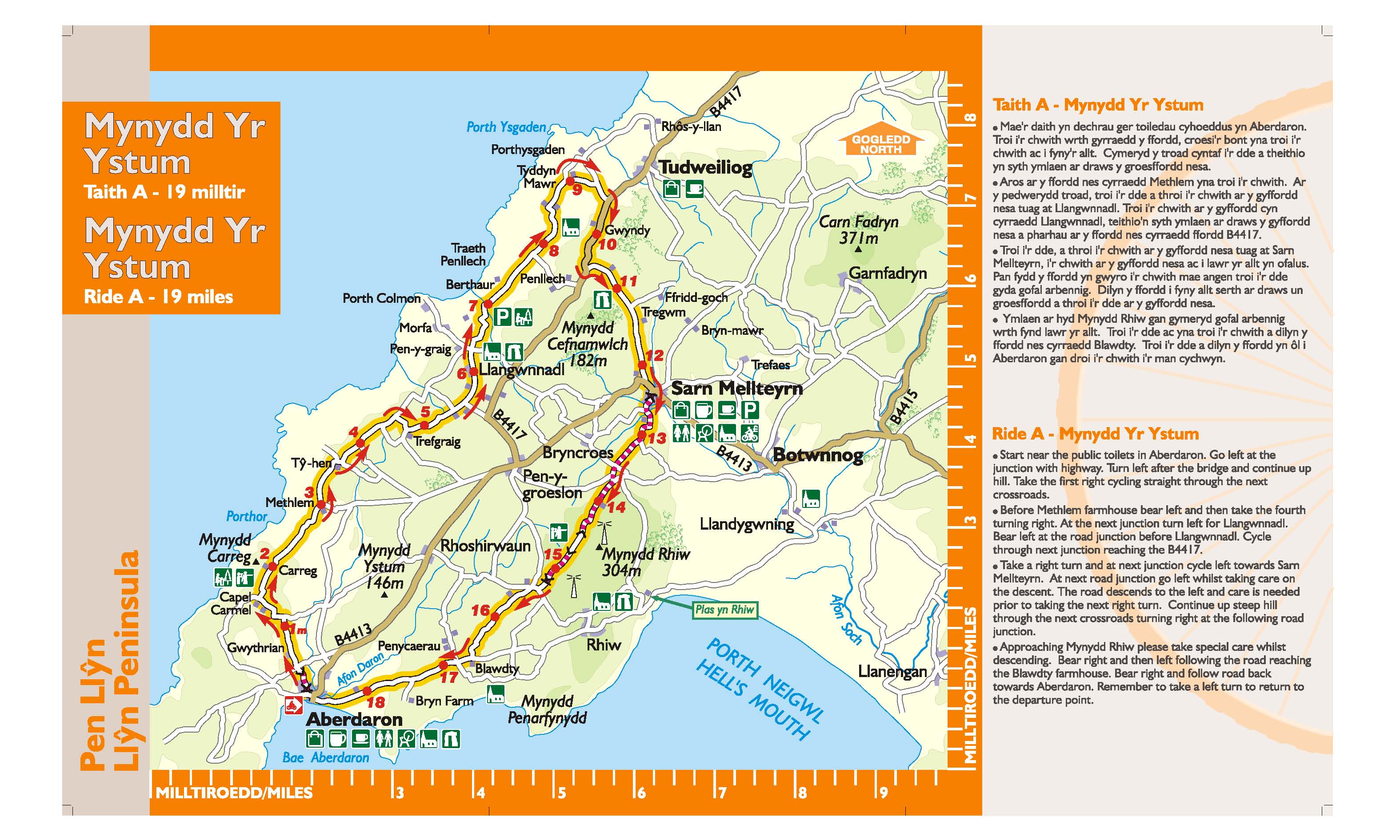
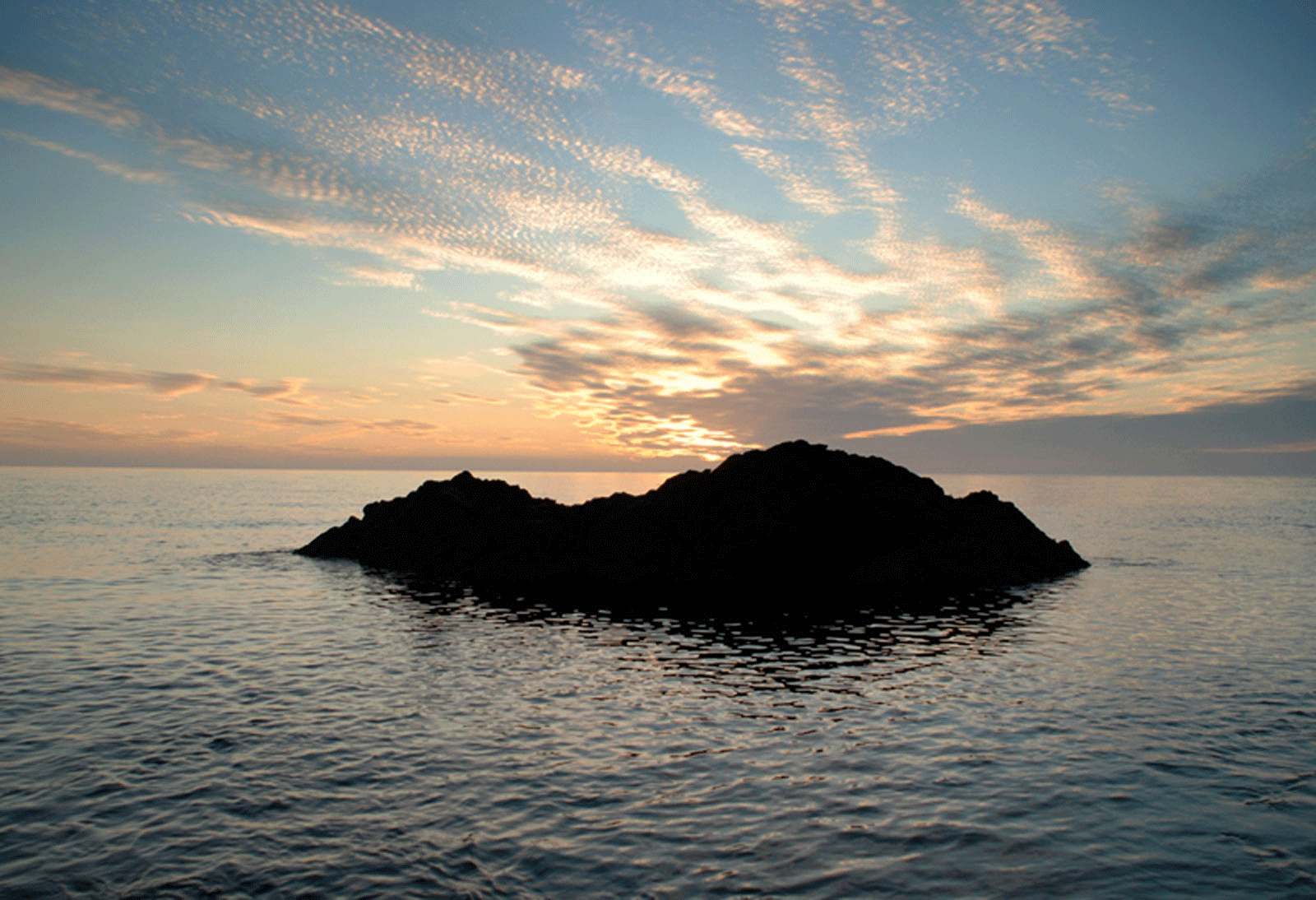
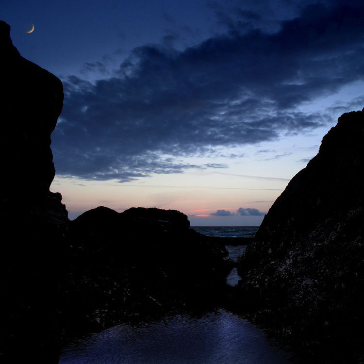
This journey begins along a section of the Pilgrims’ Way to Bardsey Island in the picturesque village of Aberdaron. Here, in the church of St. Hywyn can be found two 6th Century headstones. Y Gegin Fawr, now a popular cafe, was once a stopping off point for pilgrims before the perilous crossing of Bardsey Sound. History abounds here and our trail passes an ancient burial chamber, a standing stone and a Stone Age weapons factory. The tranquil church in Llangwnnadl, another saintly destination, is also worth visiting.
Garn Fadryn
Start & Finish: Abersoch TIC
Parking: next to Abersoch Village Hall
Approximate distance: 27 miles
Time allowance: 3 – 4 hours
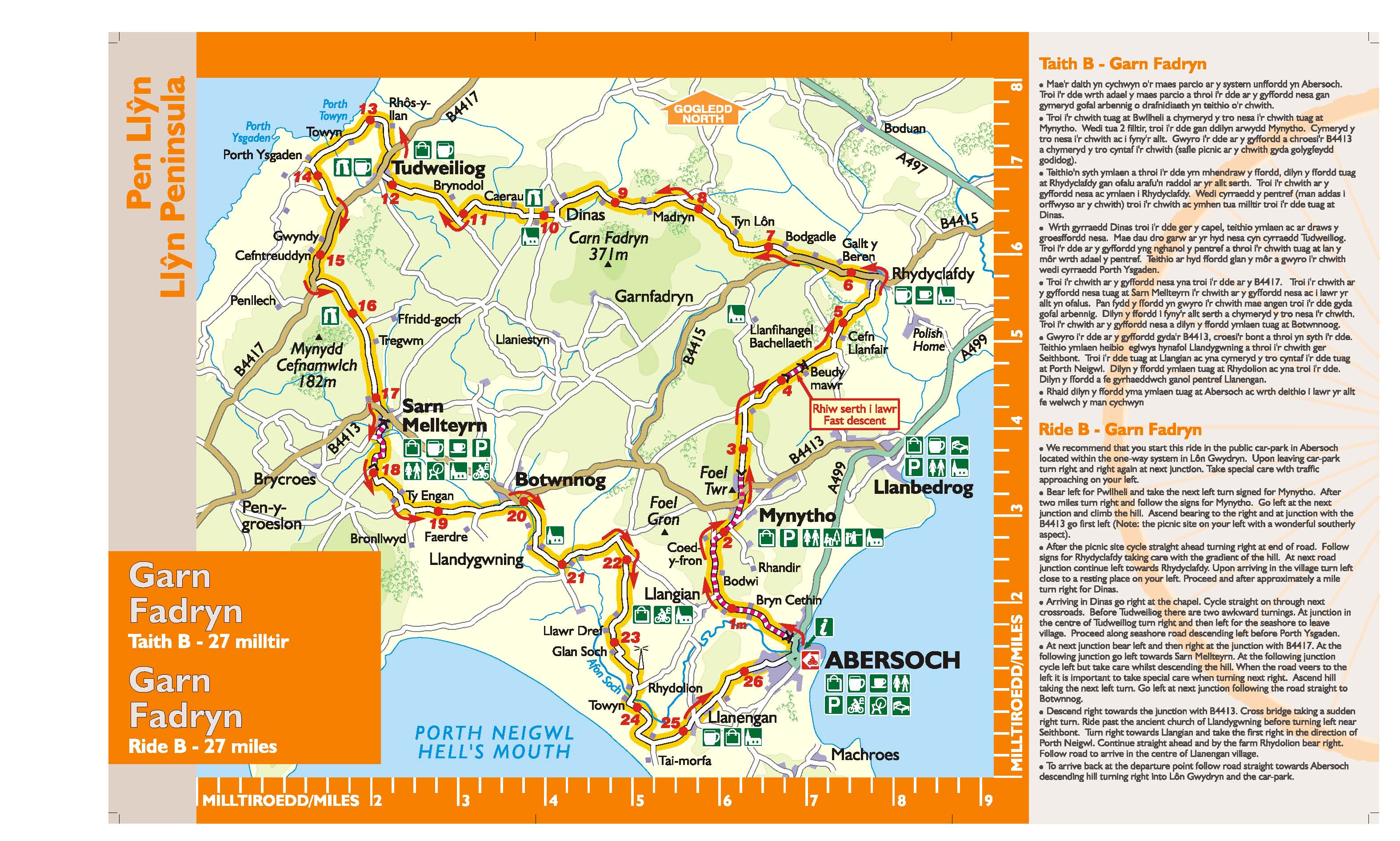
Ascending towards Mynytho, the view ahead is dominated by rocky Garn Fadryn. To the left is Porth Neigwl (Hell’s Mouth) with Ynys Enlli (Bardsey Island) beyond. From the picnic site under Foel Gron, Mynytho, there is a magnificent view across Bae Ceredigion (Cardigan Bay) to the mountains of Meirionnydd. St Tudwall’s islands lie beyond the bustle of Abersoch’s bay.
Garn Boduan
Start & Finish: Y Groes Nefyn
Parking: Stryd y Plas, Nefyn
Approximate distance: 17 miles
Time allowance: 2 – 3 hours
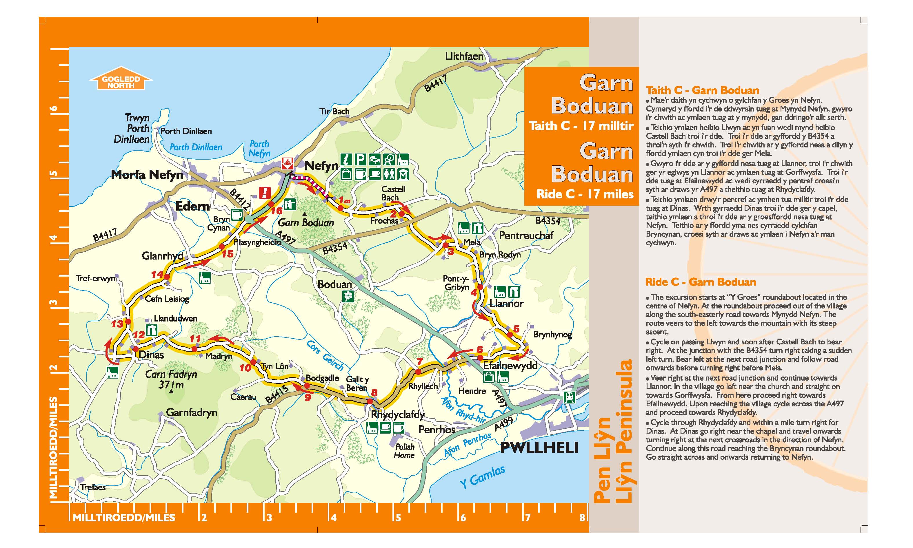
The little town of Nefyn received its charter from the Black Prince in 1355, and has a long history of seafaring. Nefyn was once famous for its herring fishing industry. The town’s coat of arms depicts three of these fish. A maritime museum is housed in the old Church. While ascending the hill to Mynydd Nefyn a splendid retrospective view of Nefyn and Porthdinllaen unfolds. These two bays were once busy ports and echoed to the sounds of ship-building. The three peaks seen to the left are known as Yr Eifl (in English the Rivals).
Garn Bentyrch
Start & Finish: Carpark opposite madryn Arms, Chwilog
Parking: opposite Madryn Arms, Chwilog
Approximate distance: 14 miles
Time allowance: 2 – 2½ hours
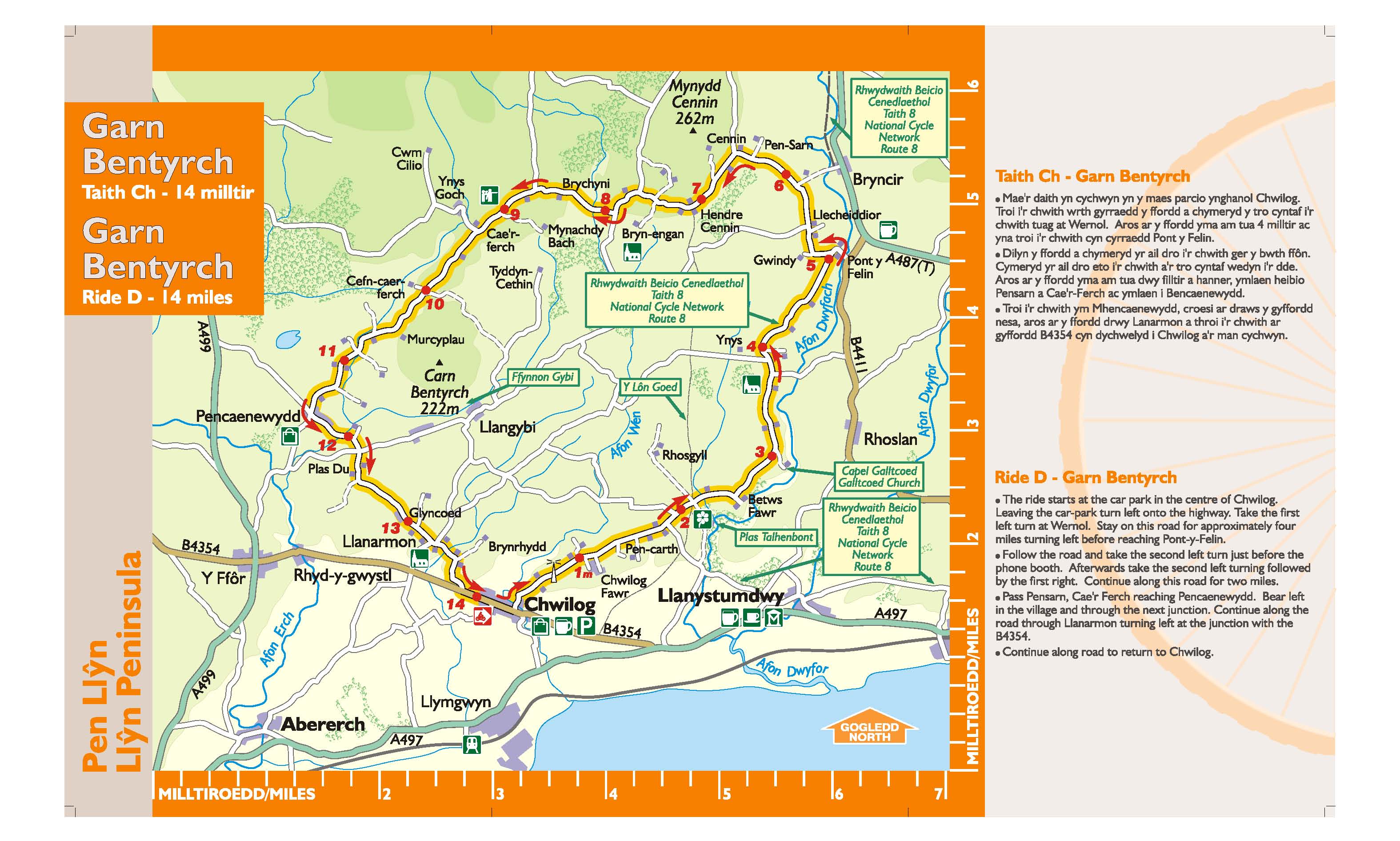
A remarkable feature of this region, known as Eifionydd, is Y Lôn Goed (lôn = lane, coed = trees). This stretches north from Afonwen near Chwilog to Brynengan on the slopes of Mynydd Cennin. Planted in the early 19th Century to serve the Talhenbont Estate, this avenue of beech and oak provides a fascinating seven mile walk. Your route crosses Y Lôn Goed near the farm of Betws Fawr and joins Lôn Las Cymru (National Cycle Nerwork Route 8) for a short section until this divides and eventually joins Lôn Eifion, part of Gwynedd Council’s countryside access network known as Lonydd Glas.