View Porth Tŷ Mawr walk with directions on a larger map
![LogoLlwybrLlynStori[1]](http://llangwnadl.org.uk/wp1/wp-content/uploads/2013/11/LogoLlwybrLlynStori1.jpg)
The Llŷn costal path is part of the national costal path. The path follows Gwynedd’s coastline, stretching 180 miles from Llanfairfechan in the north of the county, down to Machynlleth near the south of the county.
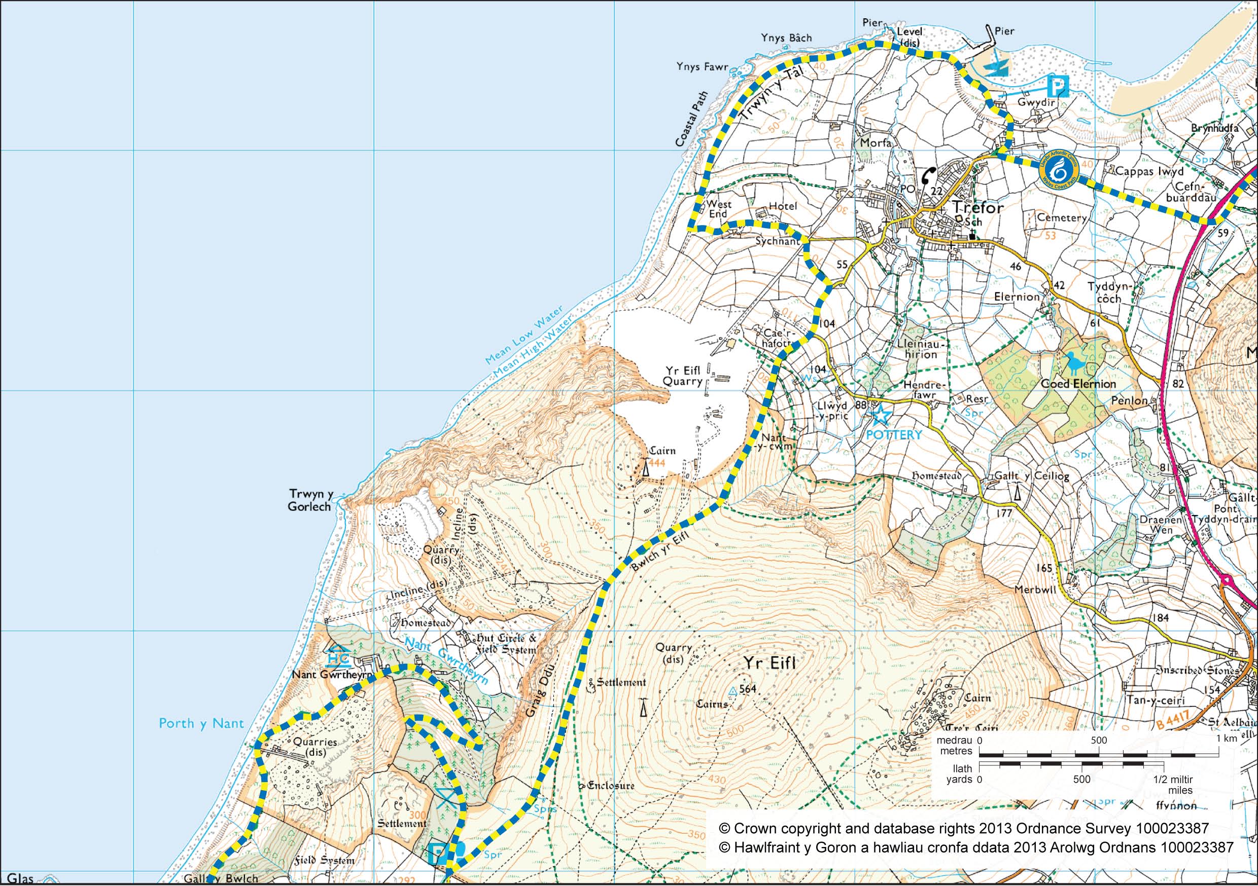
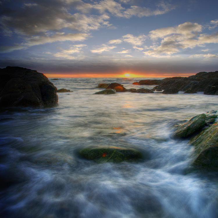
Trefor to Nant Gwrtheyrn
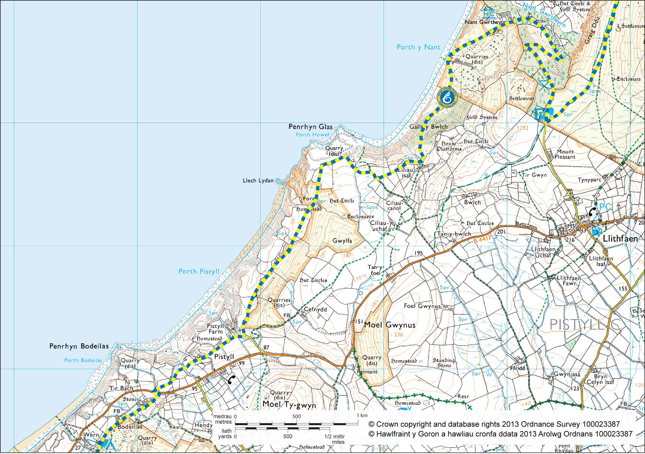
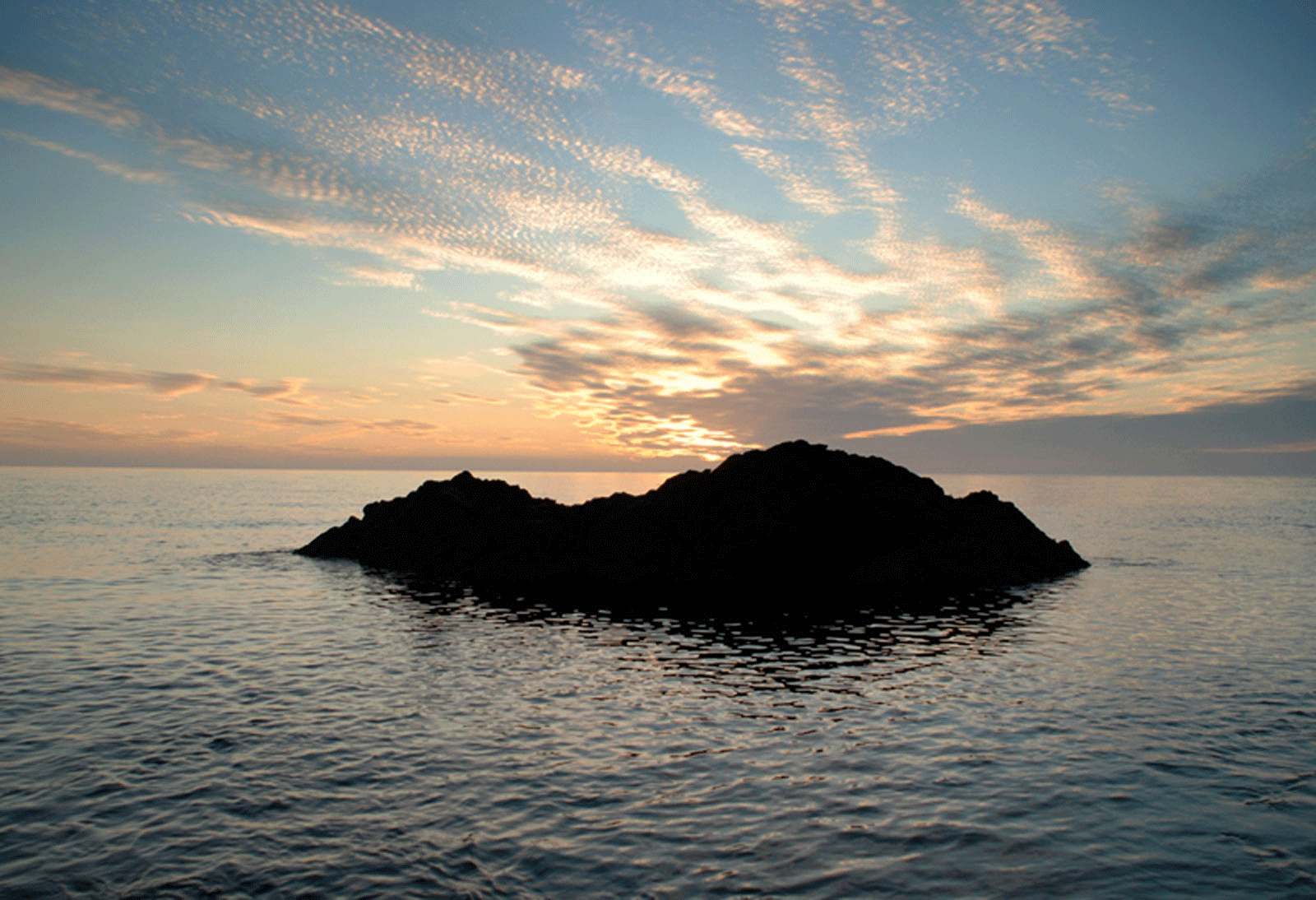
Nant Gwrtheyrn to Pistyll
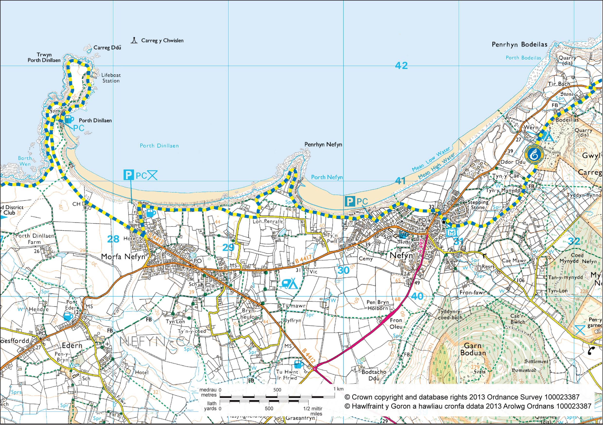
Nefyn and Porthdinllaen
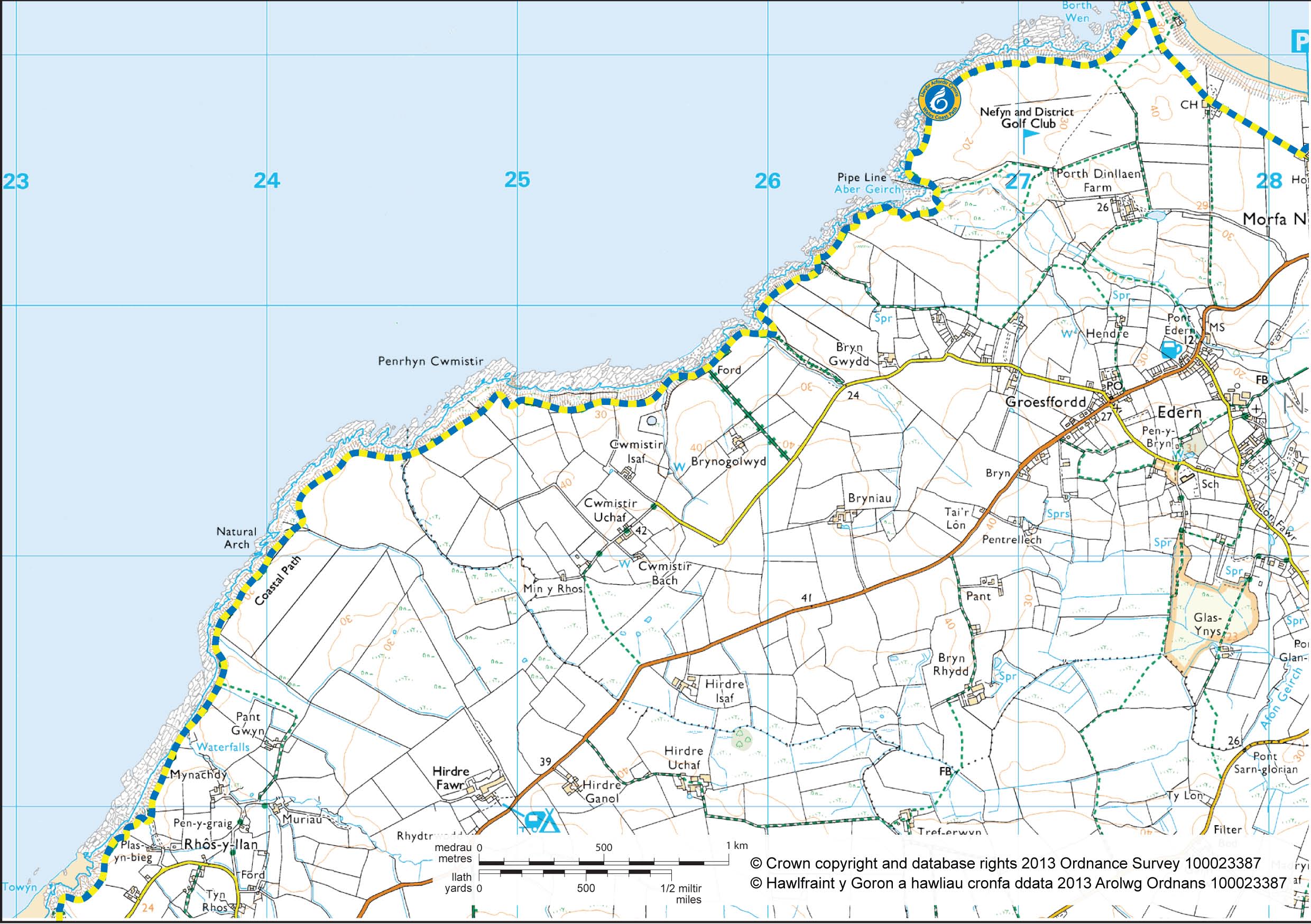
Edern to Towyn
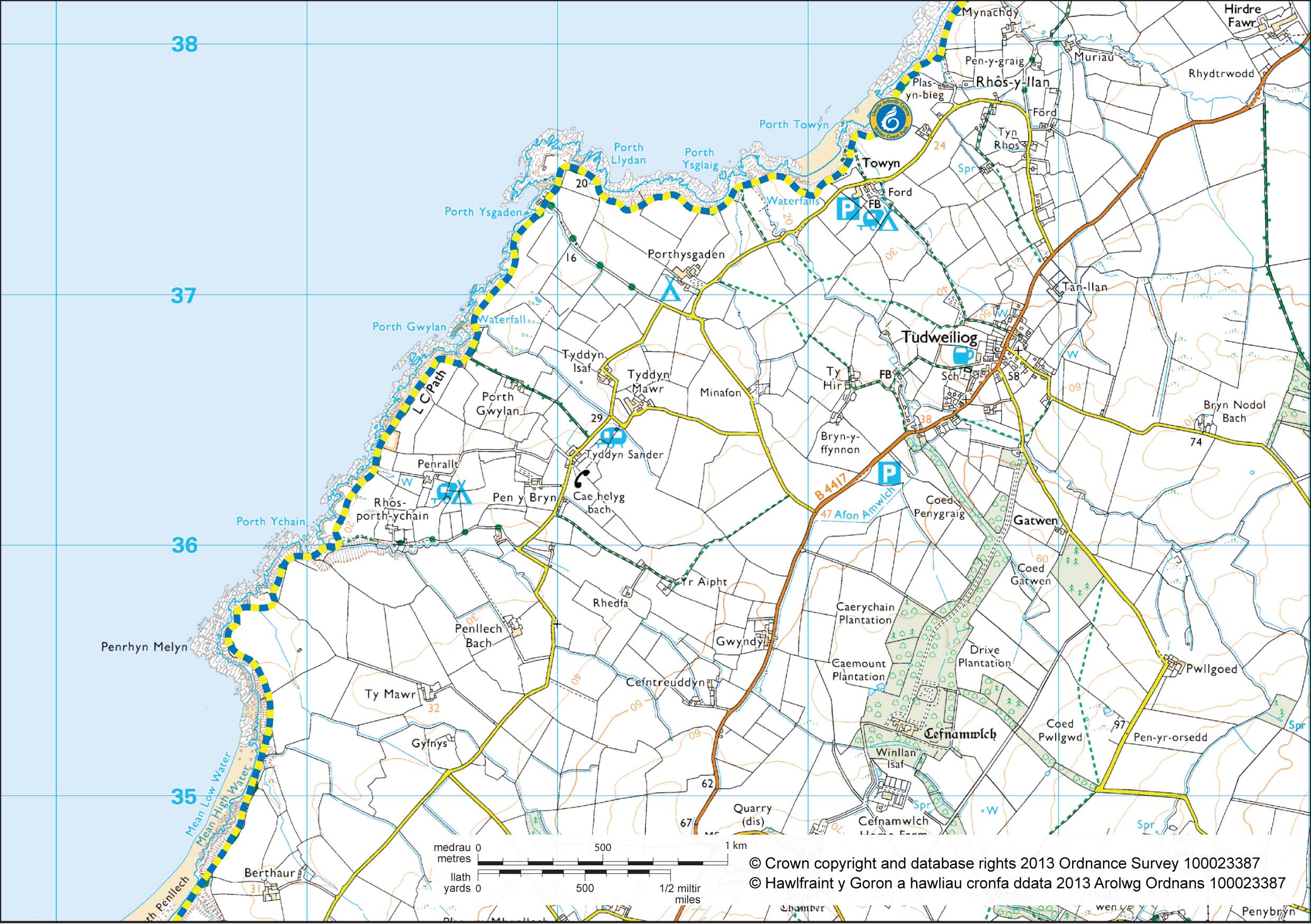
Tudweiliog to Penllech
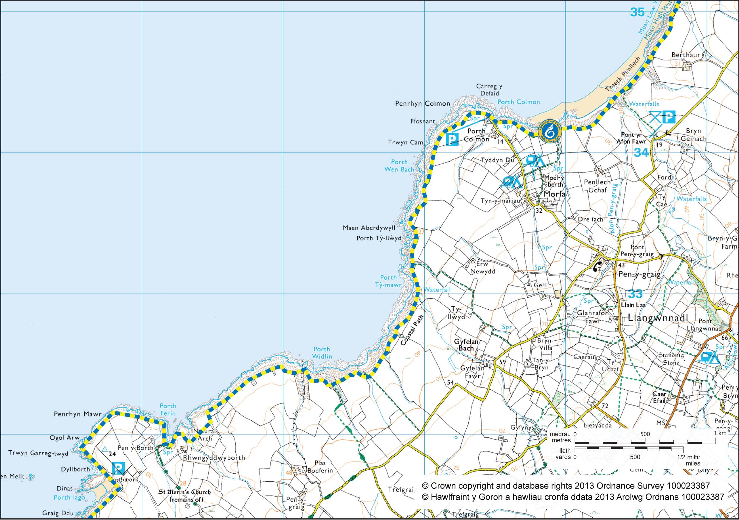
Porth Colmon to Porth Iago
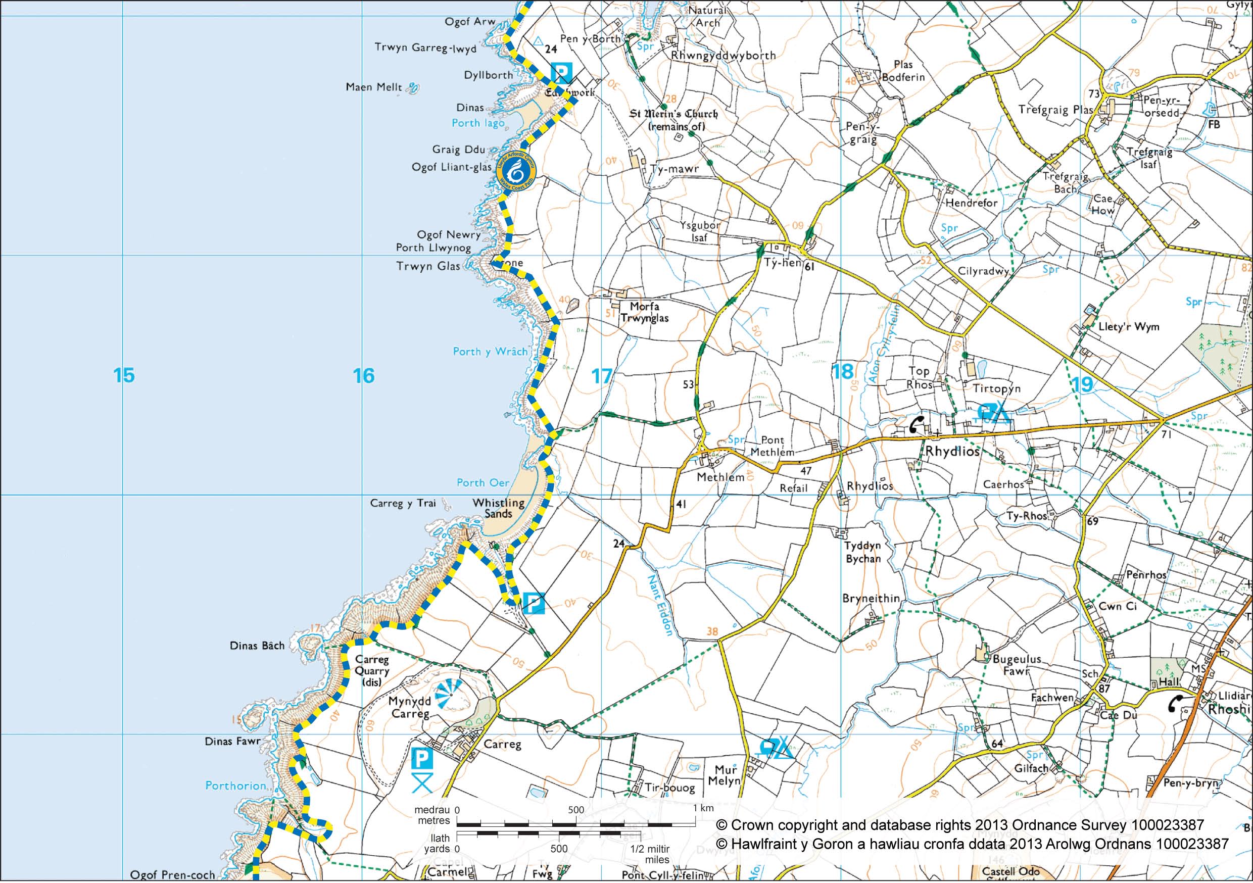
Porthor to Anelog
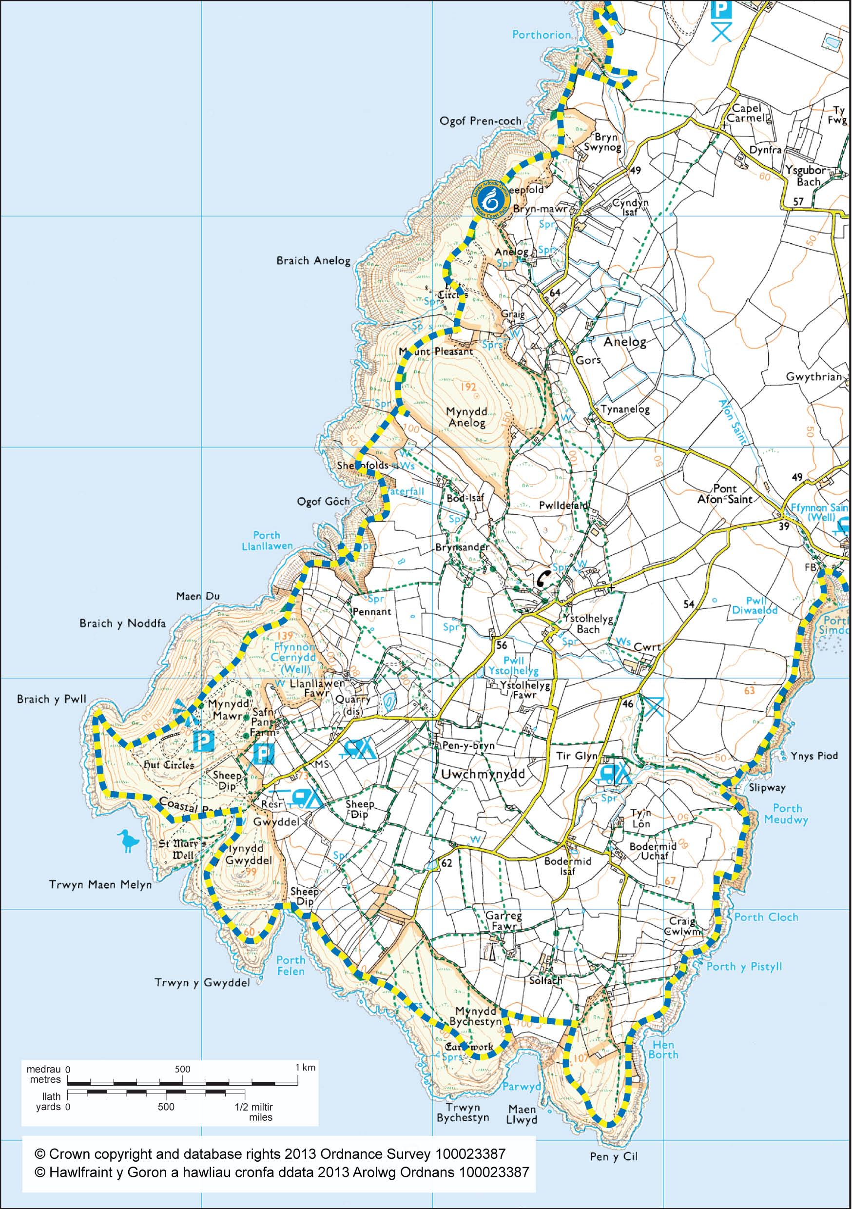
Uwchmynydd to Aberdaron

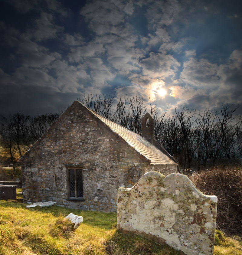
Llŷn may not be blessed with grand cathedrals and churches, the likes of St. David’s or York, but, for centuries the people of the area have built, maintained and prayed in buildings which reflect a wide Variety of architectural styles and cultural influences. Today, in towns and villages throughout the principality, it is hard to miss the relatively recent and somewhat austere presence of chapel architecture. Yet, hidden away, sometimes in the least likely places, there are much older expressions of religious devotion – churches, some so small they could be easily overlooked, which offer links back to the earliest days of Christianity – to the ancient Celtic Church which survived in this area until some time in the thirteenth century.
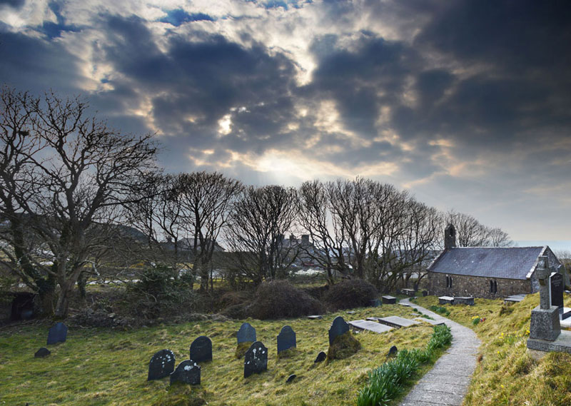
Many of the churches listed here have suffered the ravages of time and not all are ancient buildings, but each, in its way, preserves either artefacts from those early Christian times or something of the spirit of an earlier church which formerly may have occupied that or a nearby site.
Little is known of most of the “Saints” after whom these churches have been named. Some may have been early missionaries bringing the faith to the people of ancient Britain, whilst others may have been hermits living simple lives of devotion in the area. Still others may have been donors of land upon which the first churches were built. (It is interesting to note here that the WeIsh word Llan does not actually mean “Saint”, but rather is an ancient word for a consecrated enclosure within which worship and burial took place. It has now come to mean the church of the founding saint and as villages have grown up around these churches many now share the name of their original church). Whether the modern traveller is following the Pilgrims’ Trail for devotional reasons, or whether out of an interest in architecture, history or culture, today’s ‘pilgrim’ is assured of a rich and rewarding experience.
Whilst following this trail the traveller will, in places, be struck by the same sense of isolation and distance from the world as that which first attracted the early Celtic Saints. On Llŷn it is still possible to enjoy peace and quiet and to contemplate the meaning of life surrounded by nature’s bountiful beauty.
 Sadly, not all the churches listed are open daily and whilst access to some can be arranged (see individual church notice boards for details of keyholders /opening times), access to others may not be possible especially at certain times of the year.
Follow the slate plaques along the trail
The Pilgrims’ Trail is signposted in places but it is advisable to take a large scale Ordnance Survey map of the area with you.
There are, in effect, two routes – a northern and a southern route which converge at Aberdaron opposite Bardsey Island. Both modern routes attempt to follow, where possible, the trail taken by the pilgrims of old.
These early pilgrims would have been conveyed by boat across the dangerous water to Bardsey but these days access to the island is somewhat limited due to its status as a National Nature Reserve.

The Pilgrims’ Trail Interactive Maps - http://www.penllyn.com/1/Hanes/Crefyddol/index.html
![Llwybr-Arfordir-Cymru[1]](http://llangwnadl.org.uk/wp1/wp-content/uploads/2013/11/Llwybr-Arfordir-Cymru1.jpg)
For more information go to The Wales Coastal Path Website
Mynydd yr Ystum
Start & Finish: Aberdaron
Parking: Centre of Aberdaron
Approximate distance: 19 miles
Time allowance: 2-3 hours
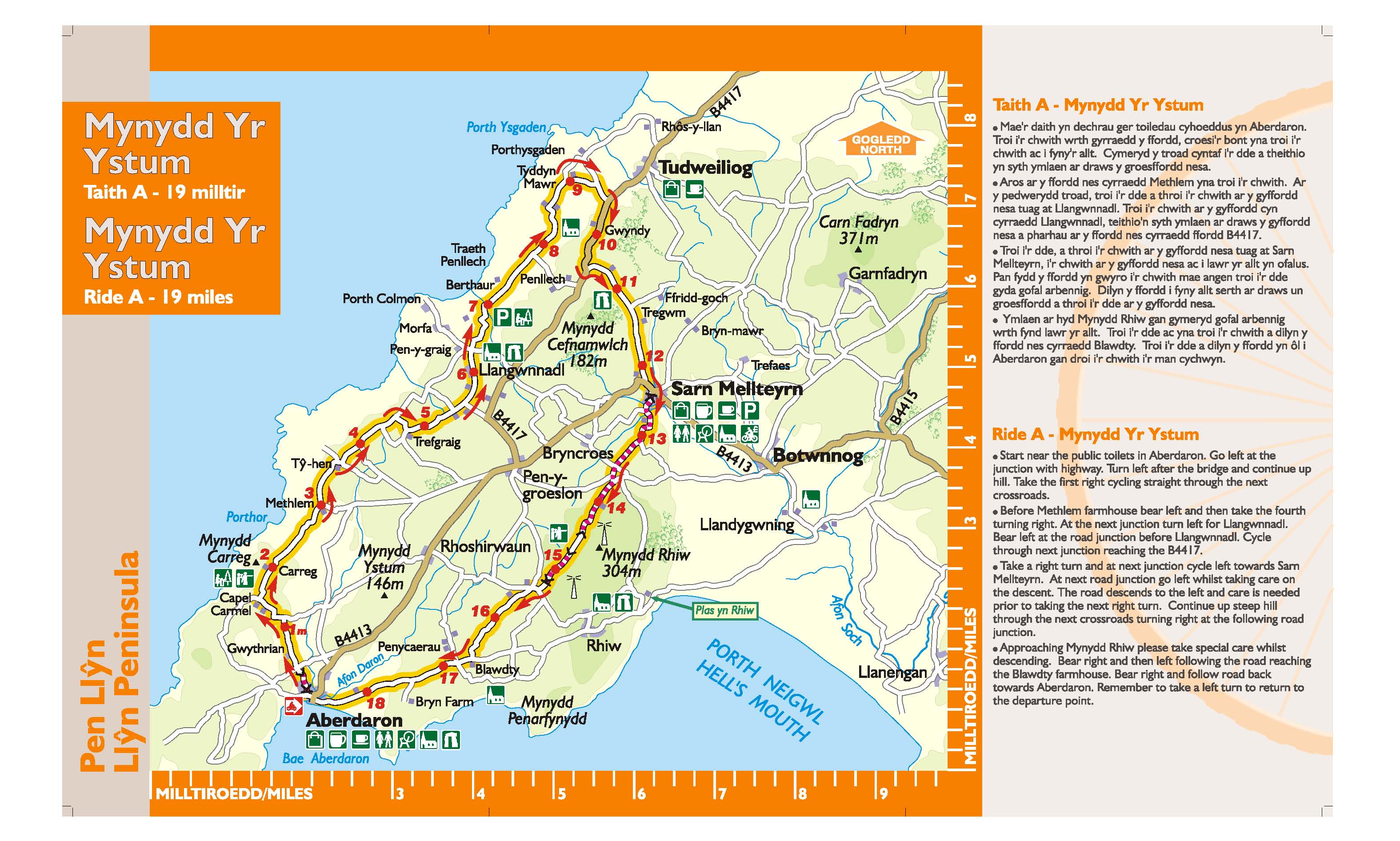
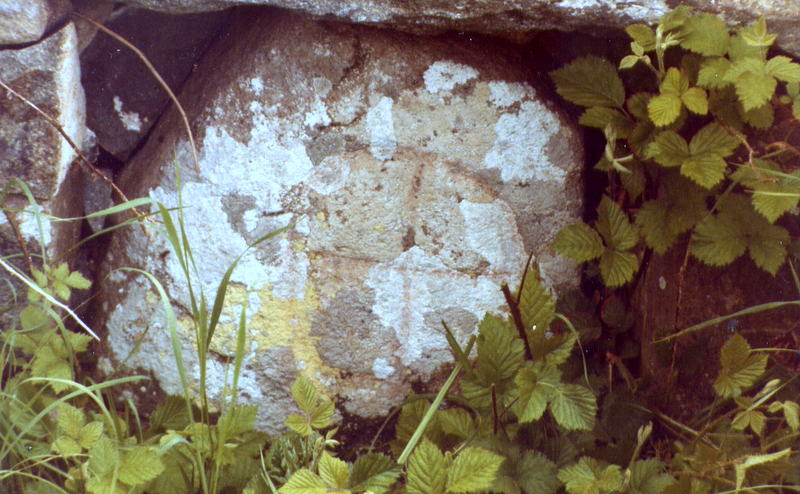
This journey begins along a section of the Pilgrims’ Way to Bardsey Island in the picturesque village of Aberdaron. Here, in the church of St. Hywyn can be found two 6th Century headstones. Y Gegin Fawr, now a popular cafe, was once a stopping off point for pilgrims before the perilous crossing of Bardsey Sound. History abounds here and our trail passes an ancient burial chamber, a standing stone and a Stone Age weapons factory. The tranquil church in Llangwnnadl, another saintly destination, is also worth visiting.
Garn Fadryn
Start & Finish: Abersoch TIC
Parking: next to Abersoch Village Hall
Approximate distance: 27 miles
Time allowance: 3 – 4 hours
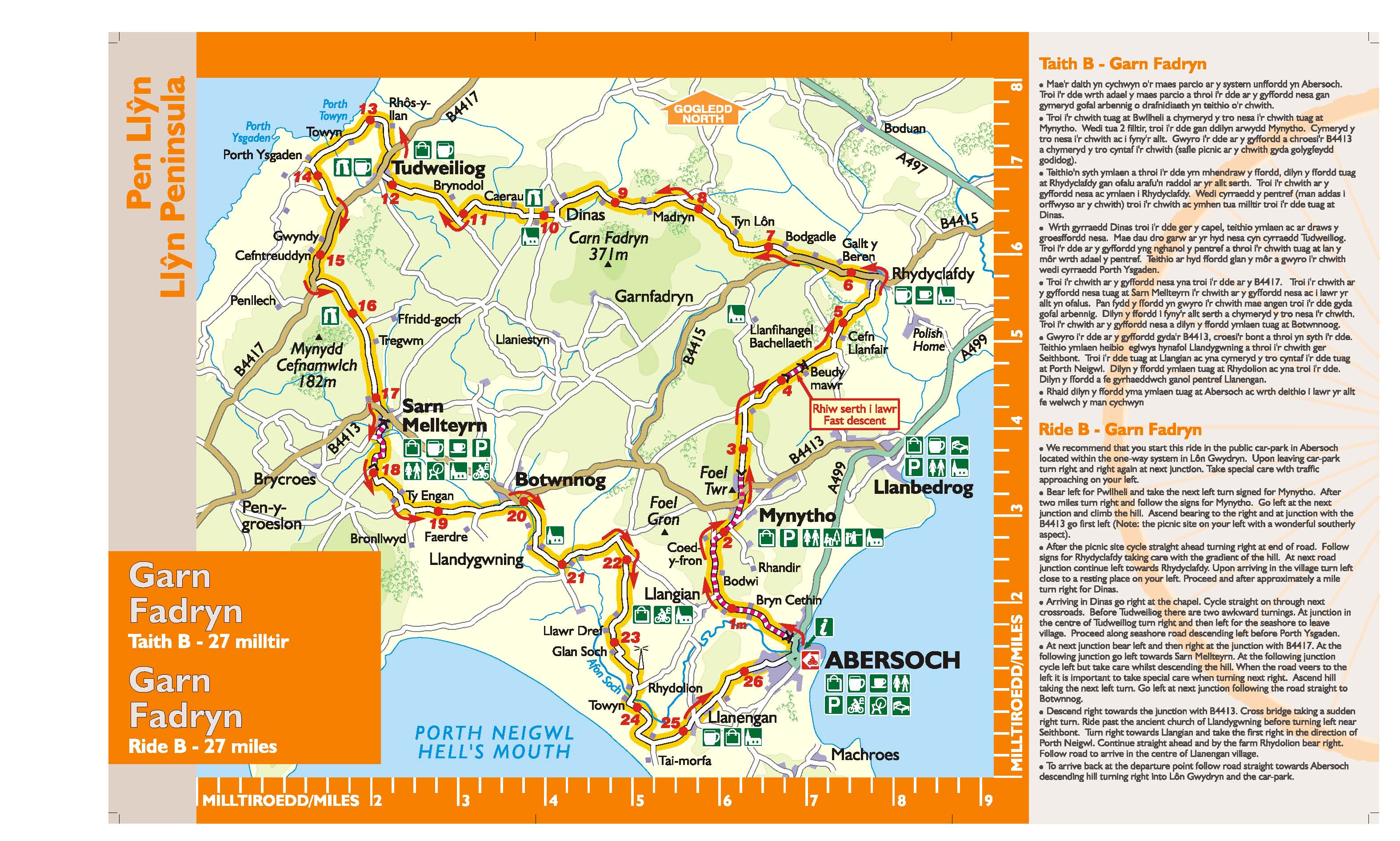
Ascending towards Mynytho, the view ahead is dominated by rocky Garn Fadryn. To the left is Porth Neigwl (Hell’s Mouth) with Ynys Enlli (Bardsey Island) beyond. From the picnic site under Foel Gron, Mynytho, there is a magnificent view across Bae Ceredigion (Cardigan Bay) to the mountains of Meirionnydd. St Tudwall’s islands lie beyond the bustle of Abersoch’s bay.
Garn Boduan
Start & Finish: Y Groes Nefyn
Parking: Stryd y Plas, Nefyn
Approximate distance: 17 miles
Time allowance: 2 – 3 hours
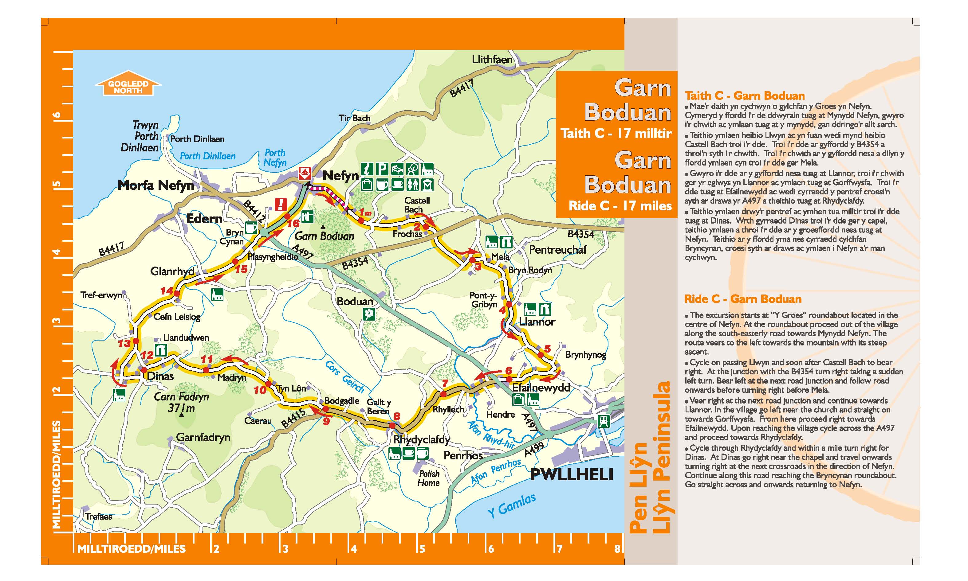
The little town of Nefyn received its charter from the Black Prince in 1355, and has a long history of seafaring. Nefyn was once famous for its herring fishing industry. The town’s coat of arms depicts three of these fish. A maritime museum is housed in the old Church. While ascending the hill to Mynydd Nefyn a splendid retrospective view of Nefyn and Porthdinllaen unfolds. These two bays were once busy ports and echoed to the sounds of ship-building. The three peaks seen to the left are known as Yr Eifl (in English the Rivals).
Garn Bentyrch
Start & Finish: Carpark opposite madryn Arms, Chwilog
Parking: opposite Madryn Arms, Chwilog
Approximate distance: 14 miles
Time allowance: 2 – 2½ hours
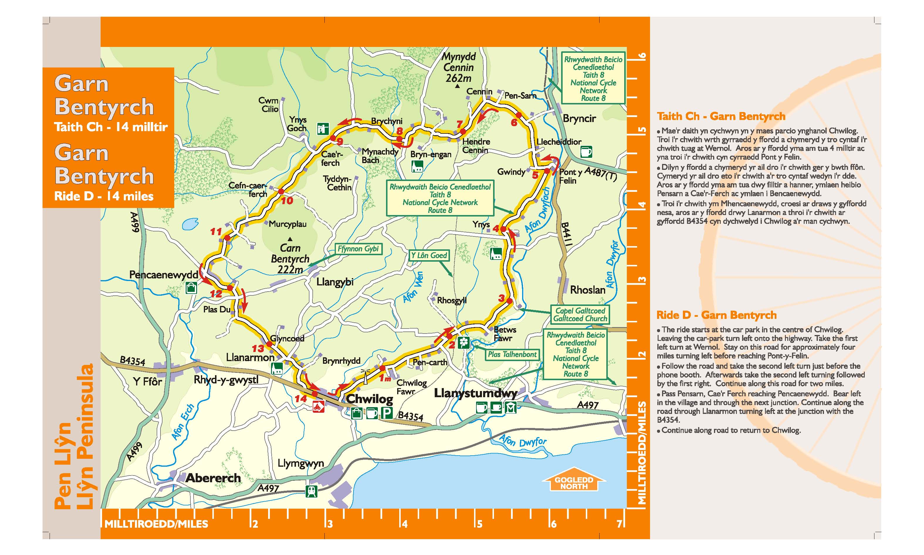
A remarkable feature of this region, known as Eifionydd, is Y Lôn Goed (lôn = lane, coed = trees). This stretches north from Afonwen near Chwilog to Brynengan on the slopes of Mynydd Cennin. Planted in the early 19th Century to serve the Talhenbont Estate, this avenue of beech and oak provides a fascinating seven mile walk. Your route crosses Y Lôn Goed near the farm of Betws Fawr and joins Lôn Las Cymru (National Cycle Nerwork Route 8) for a short section until this divides and eventually joins Lôn Eifion, part of Gwynedd Council’s countryside access network known as Lonydd Glas.